1- Derby - map of postcode area (DE) with cities and major roads
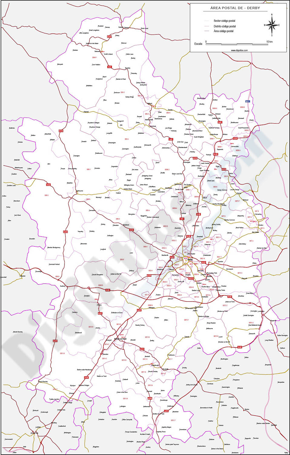
Vectorized and fully editable map of Coventry postcode area (DE). Map includes cities, major roads, postcode districts and postacode sectors.
Adobe Illustrator, PDF, JPG (300dpi)
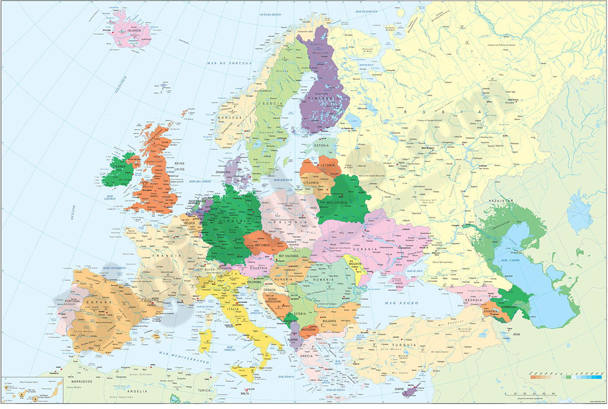
2- Europe political and geographical map
Digital physical and geographical map of Europe.
Digital cartography of the entire European continent with relevant physical and political information. Includes country borders, capitals, major rivers and lakes, important cities and geographical... Read more
Adobe Illustrator, Acrobat PDF + TIFF
3- Map of Cayman Islands
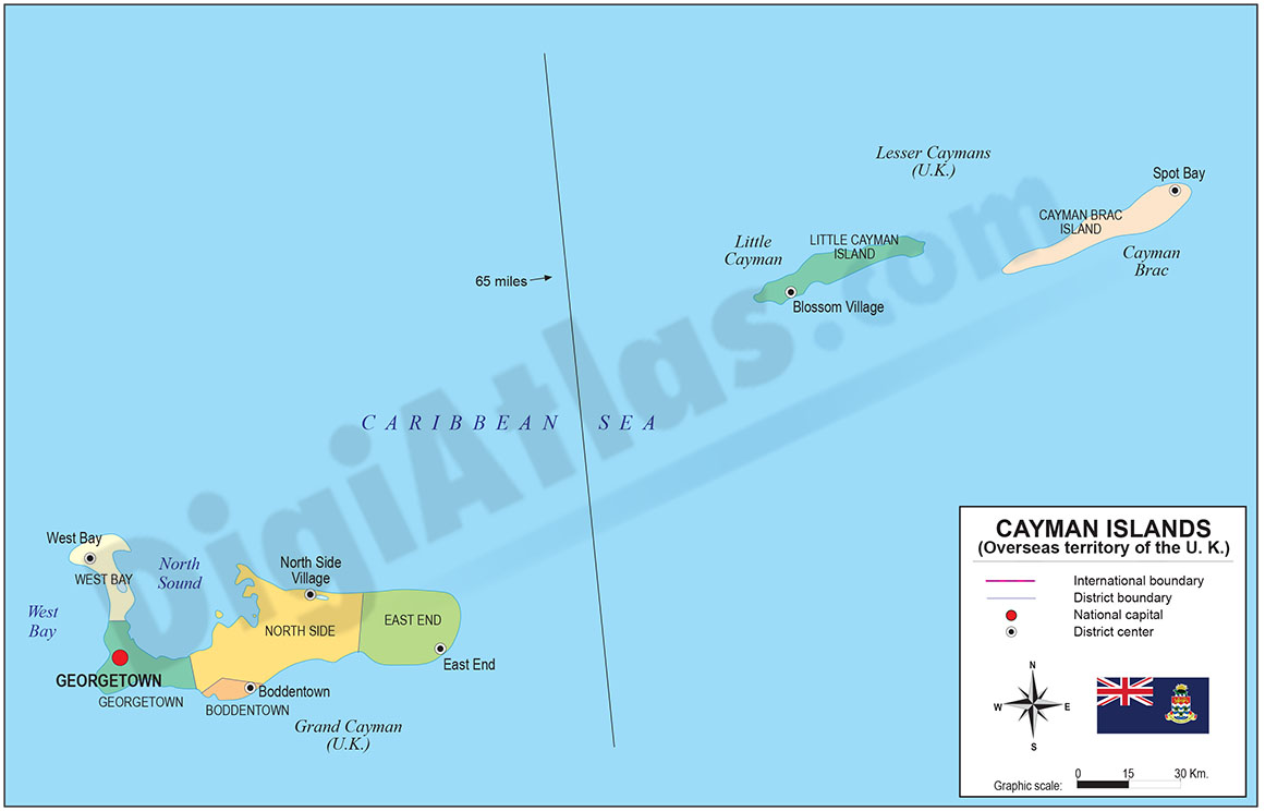
Digital political map of Cayman Islands with internal administrative division, districts, names and capitals.
100% editable vector map organized in separate layers.
Adobe Illustrator, Acrobat PDF
4- Map of United Kingdom
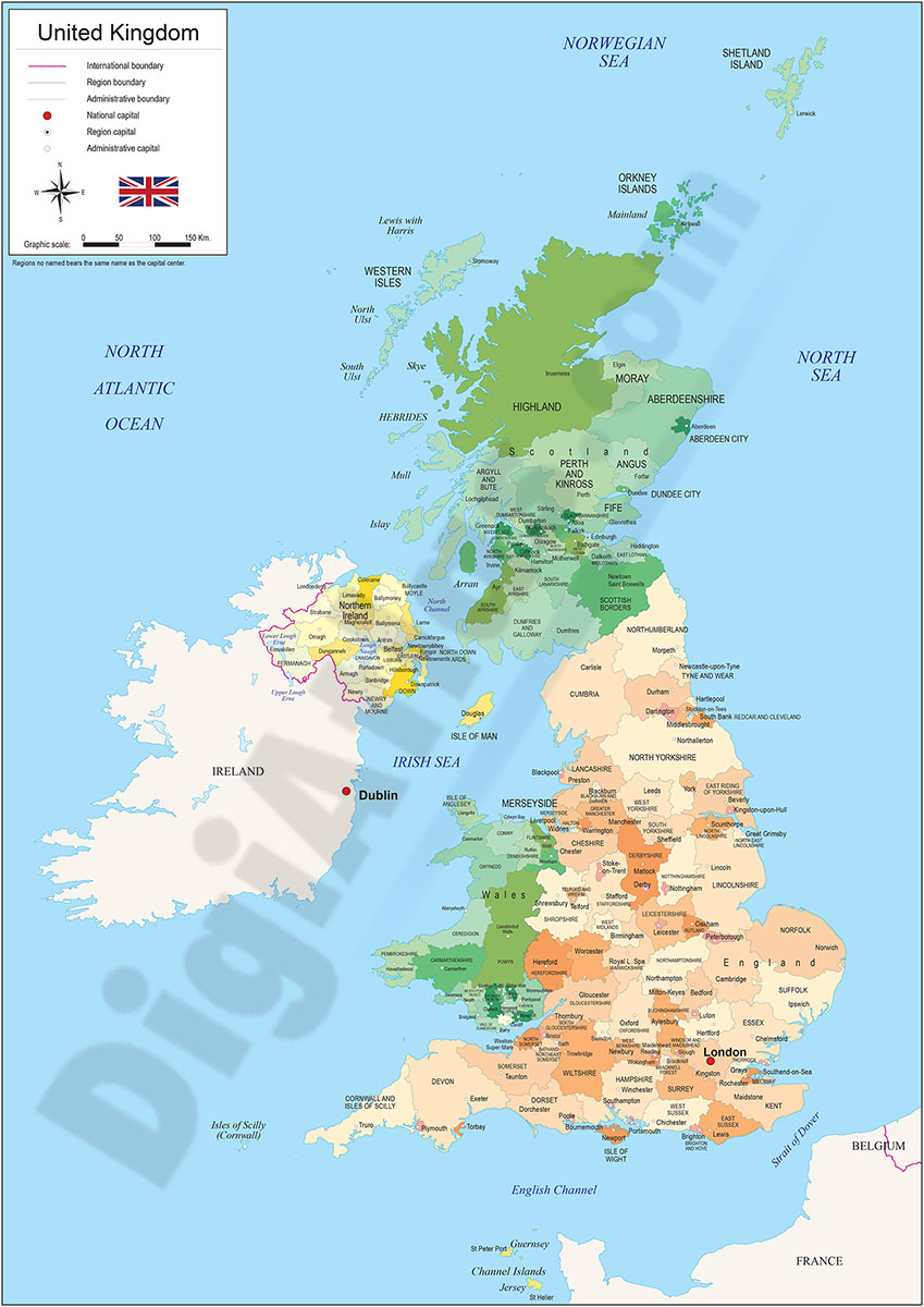
Digital political map of United Kingdom, with internal territorial organisation, names and capitals. 100% editable vector map.
Adobe Illustrator, Acrobat PDF
5- Map of United Kingdom with regions and Postal Codes
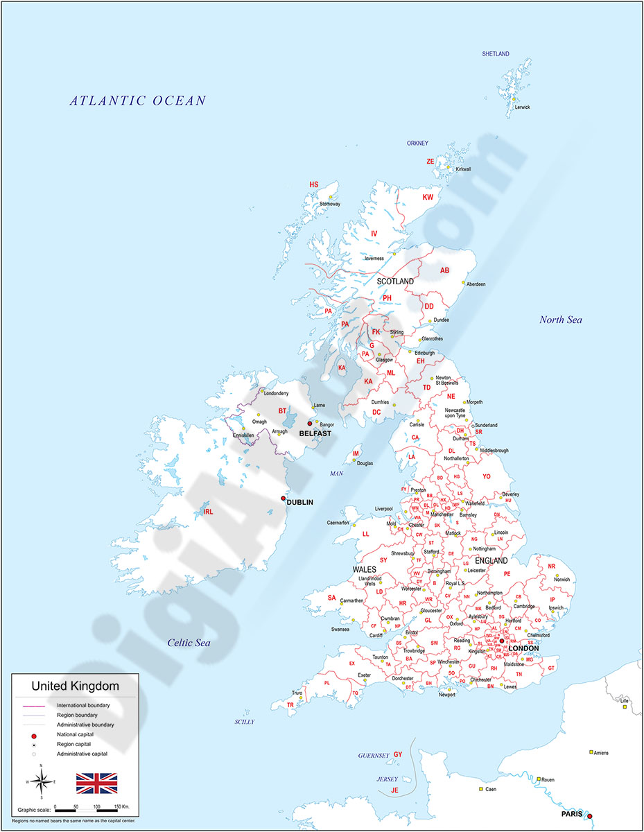
Digital map of the United Kingdom with regions, capitals and 2-digit postcodes.
Vectorized and fully editable map, available in editable and well organised in separate layers so that colours, text and styles can be modified.
Adobe Illustrator, Acrobat PDF